Searching for Information Within a Buffer
The map viewer on Canterbury Maps can be used for simple tasks, but there is also the ability to string together multiple tools to perform more advanced analysis. The following can be used in many scenarios by adjusting the buffer distance and data used (eg resource consents, monitoring sites etc).
How do I find all the wells within a 1km radius of a land parcel
1. Open the map viewer and find the property of interest
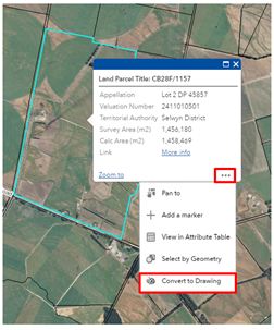
2. Click on the land parcel to select it
3. Click the three dots in the corner of the popup and select ‘convert to drawing’
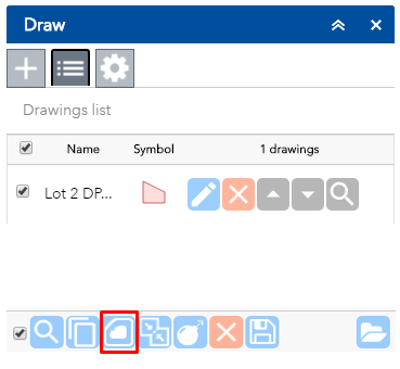
4. The draw tool should open and contain the land parcel you selected
5. Select this drawing (by clicking on the tick box next to it) and select the buffer tool down the bottom of the draw tool
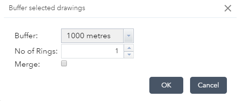
6. Select the buffer size you require from the pre-set list or choose ‘custom’ if the size you want is not there. Click ‘ok’, the buffer should now appear on the map
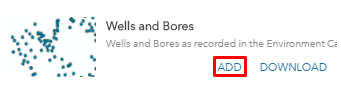
7. Go to the add data tool , in the search box type in ‘wells’ and click ‘add’ ![]()
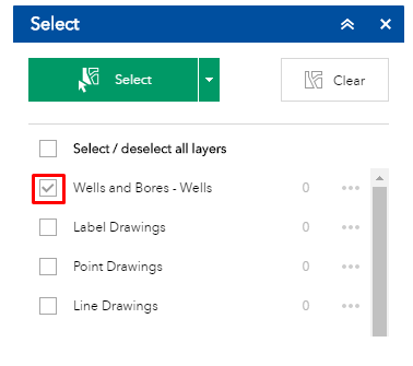
8. Go to the select tool and make sure the ‘wells and bores’ layer is ticked ![]()
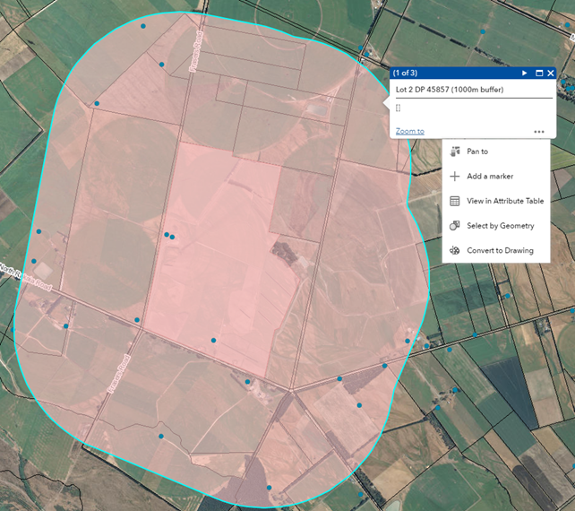
9. Exit out of this tool by clicking the cross in the top right corner. Select the buffer you created in step 6 (by clicking it), go to the three dots in the pop up and click ‘select by geometry’.
10. This will open the select tool again and display the number of wells in the 1km buffer from the chosen property
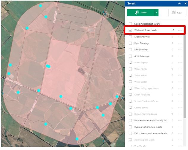
From here you can: export these features to an excel spreadsheet, view the selected wells in the attribute table, create a layer from the select and more by clicking the three dots next to the layer in the select tool