Find the nutrient levels on a property
Canterbury Maps can be used to view the level of nutrients being discharged or leached from land via water quality monitoring results.
To do this:
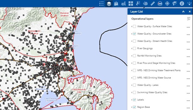
1. Open up the water quality and monitoring map
2. Make sure the water quality - groundwater sites layer is turned on in the layer list
3. Zoom into the area / property you are interested in and click on the monitoring site located in that area
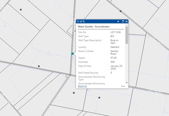
4. Scroll down the popup until you see a link that says more info
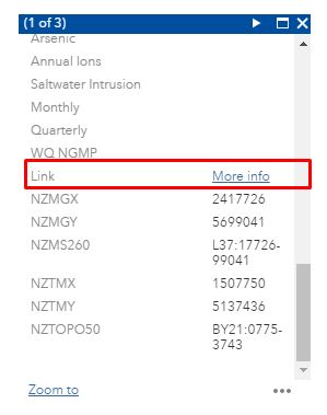
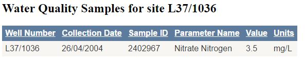
5. This will take you to the monitoring report where you can view samples taken and what nutrients were found at that location
Alternatively, you can use the standard map viewer, add the water quality - groundwater sites via the add data tool and continue from step 3.