Elevation profile tool
Click on the elevation profile tool icon  in the map viewer (located underneath the address search) to toggle the tool on and off.
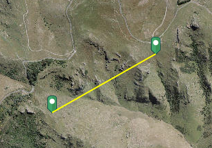
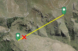
Select the measure icon to start drawing an elevation profile line on the map.
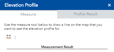
Draw your line and double click to finish.
An elevation profile graph will be produced showing the change in elevation across your drawn line.
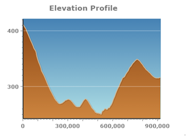
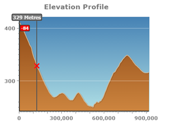
Hover your mouse over the chart to display elevations and show the location on the map.
Once you have an elevation profile, a few things can be done with it. Click on the three dots that appear in the tool:
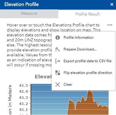
- Profile Information - Gives a summary of the profile, including the minimum and maximum elevation and what the resolution of the DEM used to create the profile is
- Prepare download - Downloads a copy of the graph generated
- Export profile data to CSV - Outputs a CSV table with the coordinates along your profile and what the corresponding elevation is
- Flip elevation profile direction - flips the direction of the profile
- Clear - Clears the profile result ready to create a new one