Opus

Company size: 3,000+
Founded: 1996
Most useful service: Historic and current aerial images, extracting data (e.g. wells information, consented activities, etc.), mapping.
Most useful map/tool: Advanced Viewer
Website: http://www.opus.co.nz
Industries work within: Transport, asset management, infrastructure, water, energy, building & architecture, planning, contaminated land, rural services, etc.
Who are we?
Opus International Consultants Ltd is a leading infrastructure consultancy with global reach and local connections. Our team of over 3,000 engineers, designers, planners, researchers and advisors work with more than 12,000 clients across Australia, Canada, New Zealand, the United States and the United Kingdom.
In New Zealand, Opus operates from a network of 40 offices and employs over 1,700 staff. We provide services on leading infrastructure projects for both the public and private sectors.
The multidisciplinary teams at Opus offices in Christchurch and Timaru bring together valuable experience and collaboration across a multitude of sectors to deliver to our clients professional consultancy services in transportation and building asset development and management; building design and construction; water and other infrastructure; and general resource management.
How we use Canterbury Maps?
At Opus many teams and individuals use Canterbury Maps to obtain accurate, up-to-date information and data, which assists in providing the high quality services to our clients that we strive for.
Opus engineers, surveyors, planners, geologists and scientists all use Canterbury Maps in their day-to-day business for high level and detailed desktop analysis. The day to day work can be for various large and small scale projects.
Examples of use in projects are:
- extracting and analysing data to provide our clients with valuable information and recommendations for making strategic decisions
- for preparation of effects assessments for resource consent applications
- for processing resource consent applications for Councils
- and for general mapping purposes
Below are examples of common activites performed by our staff.
Figure 1: Shows analysis of wells within an buffer area using the Canterbury Maps Advanced Viewer.
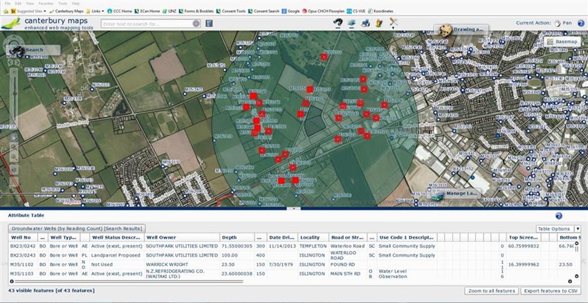
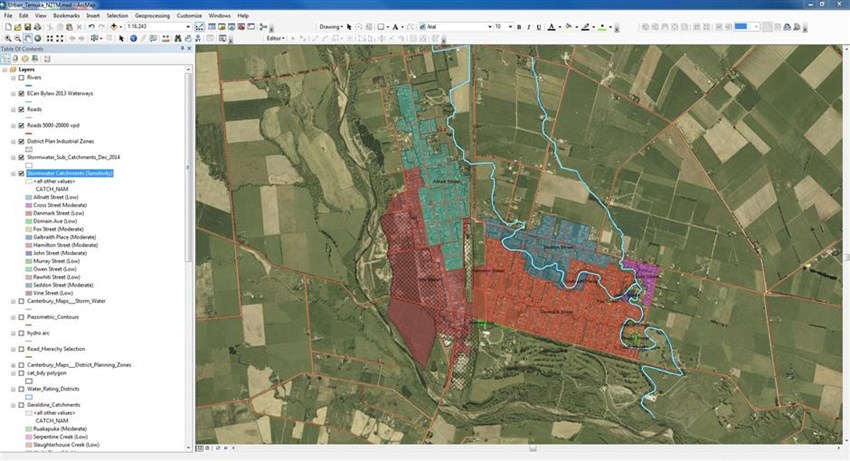
Figure 2: Shows a GIS application (ArcGIS Desktop) connected to various datasets from Canterbury Maps and other sources for Analysis.