Aurecon

Company size: > 7500 Globally
Founded: 1932
Most useful service: Canterbury Maps OpenData Portal
Most useful map/tool: Canterbury aerial photography and historical aerial photography
Website: http://www.aurecongroup.com
Industries work within: Geospatial systems, building design, ground engineering, hydrological engineering, land development, environmental, surveying, infrastructure design and project management.
Who are we?
We are a global consulting, engineering, management and specialist technical services firm with offices throughout New Zealand including Christchurch. We have expertise in building design, ground engineering, hydrological engineering, geotechnical and environmental engineering, land development, planning and advisory, environmental management, infrastructure design, project management, spatial surveying and geospatial services. Aurecon has been successfully delivering geospatial business systems and software solutions to our international clients for many years. Our extensive and globally dispersed team of geospatial professionals draw on a unique combination of industry experience, business acumen and technical knowledge to deliver innovative business solutions across a wide variety of disciplines and industries. To find out more about how Aurecon can help you with your next project please visit us at http://www.aurecongroup.com
How we use Canterbury Maps?
Our geospatial services team at Aurecon often make use of ECan’s latest aerial photography and basemap web services in our web mapping applications and static map products. These web mapping services provide the valuable contextual layer of information that allows the user to quickly locate and identify features of interest. We also make use of the historical aerial photography web service to show site usage through time, which is particularly useful for our land development team and geotechnical engineers, as well as our clients when assessing the suitability of a site for future development.
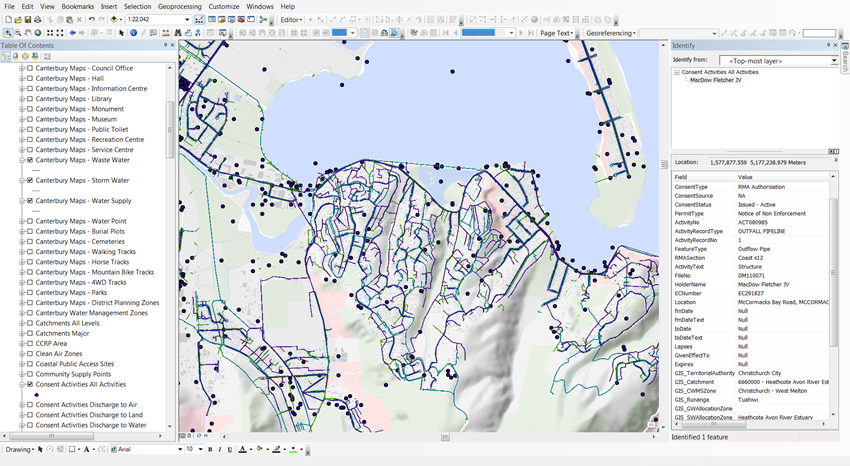
Our geotechnical engineers and planners regularly make use of the online GIS mapping system to access key property information and for identifying consented activities. We also make use of the Canterbury Maps Esri and LINZ data portals for data discovery and to obtain up-to-date data sets.
In conclusion, the data available from Ecan’s web mapping services and OpenData portal are highly valuable for Aurecon’s consultants, and provide information that adds extra value for our clients, promotes innovation and contributes to working more efficiently by making use of open and freely available data sets and services.
Below are examples of common activites performed by our staff.
Figure 1: Screen capture showing a web GIS viewer connected to various datasets and imagery from Canterbury Maps.
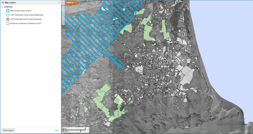
Figure 2: Screen capture showing Canterbury Maps data and basemap services loaded into a GIS application (ArcGIS Desktop) for investigation.