News
Imagery collections on Canterbury Maps
Canterbury Maps hosts a wide range of imagery captured in the Canterbury region. You can find historic aerial imagery dating back to 1926, new aerial imagery taken each summer and hazard event imagery such as flooding, earthquakes or fires. These collections have been captured by a range of sources for various purposes. Continue reading to find out how you can view these imagery collections within the Canterbury Maps applications.
Historic imagery
The historic imagery on the Canterbury Maps website was captured for various reasons, including basic topographical information, geological surveys, power transmission, roading and defence purposes among others.
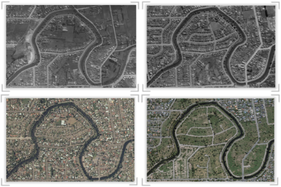
This dates back to the 1920s and until recently, the imagery was stored in film canisters in a vault where they were difficult to access and began to decay. In 2015, the Local Government Geospatial Alliance (LGGA) and Land Information New Zealand (LINZ) began a scanning project to prevent this important record of our history from being lost forever.
At Environment Canterbury the process is taken even further. We remove metadata around the film edge and give each image a location on the map through a process called 'georeferencing'. Each summer, university students complete this work and add their progress to the Canterbury Maps historic basemaps for public viewing. The basemaps are grouped in five-year blocks to easily manage the datasets, however, specific capture dates can be found by adding the 'Historic Aerial Imagery - Extents' layer to the map viewer.
The further processing of the images provides our Canterbury Maps partners with information for better decision making by using the images to support the potential identification of contaminated land sites, movement of coastlines, changes in areas of significant vegetation, river engineering and land-use change over time.
How to access the historic imagery
The time slider in the Property Search application is the easiest way to view the historic imagery collections. Simply type in your address or the location you want to see and use the time slider at the bottom of the page to view the imagery. You will notice the imagery isn’t available everywhere. These collections grow each summer as the imagery is processed and made available.


If you want to print the map, you are best to access the image through the Map Viewer and the basemap gallery. Here you will also find the specific dates each imagery dataset was captured. For further guidance, see our instructions on how to find dates of capture.
Latest imagery
Each summer the 11 Canterbury councils, together with a public-private partnership, capture a different area of the region, over what is now a decade-long programme. Thousands of individual photographs are then combined to provide a continuous surface all across Canterbury. The digital photographs are captured using a specialist high powered camera on board an aircraft flying at an altitude of 1400m, during optimum weather conditions to minimise shadowing. Images are then processed to ensure correct geographic location and overlapping, and then terrain is flattened in a procedure called 'orthorectification'.
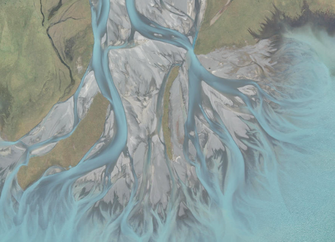

Aerial photographs provide the real-world context to our location information for local councils and Environment Canterbury’s wide variety of functions, including monitoring land use, traffic management, managing public and private utility networks, property information and developing Farm Environment Plans. Regionally, it is used as part of our processes in hazard identification, coastal erosion, climate change monitoring, river engineering including flood control, biosecurity, environmental monitoring, regional policy and planning and for considering applications for certain resource consents – land use consents, coastal permits, water permits, discharge permits and planning public passenger transport. In the event of a disaster, the imagery is also a record of what the prior state was before an event.
How to access the latest imagery
You can view the aerial photographs in 2D in Canterbury Maps Viewer or in 2D and 3D in the Canterbury Maps Property Search, which is best experienced on a tablet or desktop computer.
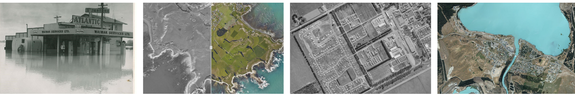
Flood imagery
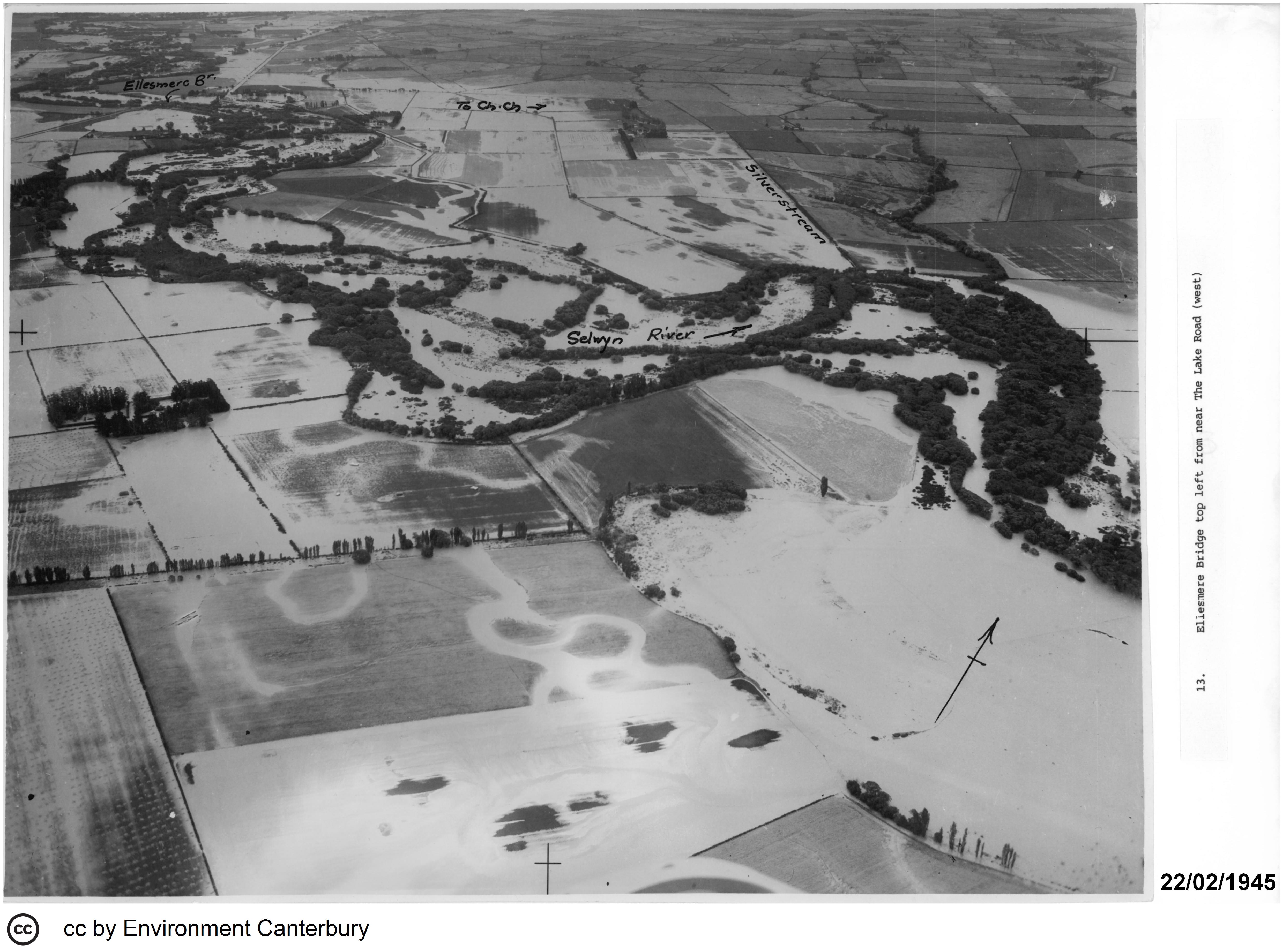
Environment Canterbury monitors flooding in the Canterbury region and maintains a collection of oblique (taken on an angle) and vertical aerial photographs and ground photographs taken during (or following) past flood events. The locations of most photographs held by us have been mapped.
For areas north of the Rakaia River, the field of view for each oblique aerial photograph is marked by a line and arrow. South of the Rakaia, oblique photos are currently marked with just an arrow, but these are in the process of being re-mapped in the same format as for those north of the Rakaia. In both areas, the field of view for vertical aerial photographs are marked by a polygon, and ground photographs are marked by a point to indicate the location that the photograph was taken from. Flood imagery provides a record of the flooding event and aids in future planning, river engineering and flood control.
How to access the flood imagery
First, visit the Flood Imagery Register. Then type in your address and the imagery available will appear on the right-hand panel. You may need to zoom out until you get some results. Use the map to pan and zoom to search available imagery. This can be previewed by selecting a thumbnail in the side bar. Imagery can also be sorted and filtered by date in the side bar menu.