News
Three Waters & District Planning Zones regional data update
You can now find out valuable information about nodes and pipelines for water supply, stormwater and waste water across Canterbury. Ever wondered what type of activity an area of land is zoned for? You can now find this out too!
Three Waters and District Planning Zones data have previously been scattered across several datasets, often out of date and not regionally standardised. This data has now been consolidated from Canterbury's territorial authorities into single regional datasets and is automatically updated monthly.
Check it out in the Map Viewer or download it from Open Data.
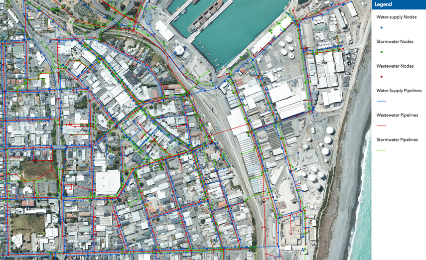
Three Waters Data
Three Waters assets information is important to protect drinking water and design effective stormwater systems as our climate changes.
The data includes hyperlinks to the host datasets and webmaps held at each district council. The dataset includes the following layers:
-
Water-supply nodes & pipelines
-
Stormwater nodes & Pipelines
-
Wastewater nodes & pipelines
View the new regional Three Waters layers in the Map Viewer or download the data from Open Data.
Note: Waimakariri District are working to modernise their asset information digitally and we will bring that to you as soon as they make it publicly available.
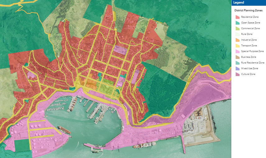
District Planning Zones
Regional district planning zones tell you what kind of activity an area is used for, ie. residential, industrial, cultural etc.
The zones are essential to plan rapidly growing communities and transportation links.
View the new regional district planning zones layer in the Map Viewer or download the data from Open Data.