News
Christchurch’s largest elevation dataset is now publicly available
View Ōtautahi/Christchurch online in 3D with the newly captured Christchurch City elevation (LiDAR) dataset!
The Christchurch Elevation (LiDAR) High Density dataset was captured between December 2020 and February 2021. It was captured with a high pulse density (up to 16 pulses per square meter), meaning there are a high number of data points for every square meter, resulting in better representation of real life features such as trees and buildings. The dataset is the largest single survey of Christchurch ever and is the most comprehensive and accurate publicly available LiDAR dataset in Canterbury.
The dataset will be a great resource for:
-
mitigating the impacts of climate change
-
measure more accurately areas that are at risk of flooding and liquefaction
-
planning new development and transport options
-
calculating tree canopy cover and so much more!
This dataset is now freely available through a collaboration with Christchurch City Council, Toitū Te Whenua Land Information New Zealand and Environment Canterbury. The dataset is available to view on Canterbury Maps or to download as a ground elevation model (DEM), an above ground surface model (DSM) or raw data as LAS Point Cloud.
Check it out in the Canterbury Maps 3D Viewer.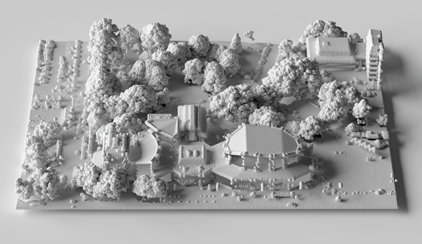
Visualisation of Christchurch City Town Hall, generated using the Christchurch Elevation (LiDAR) High Density point cloud dataset.
Credit: Toitū Te Whenua Land Information New Zealand
What is LiDAR?
"Elevation data or LiDAR (light detection and ranging) is a technology using laser sensors mounted on aircraft that fly over a landscape to capture a 3D view of the land. The sensor measures the time it takes for light to travel back and forth from the sensor to the ground. Because the sensor can rapidly pulse a laser beam, it can capture a "point cloud" of highly accurate 3D measurements – like a digital twin of the landscape." - Elevation Aotearoa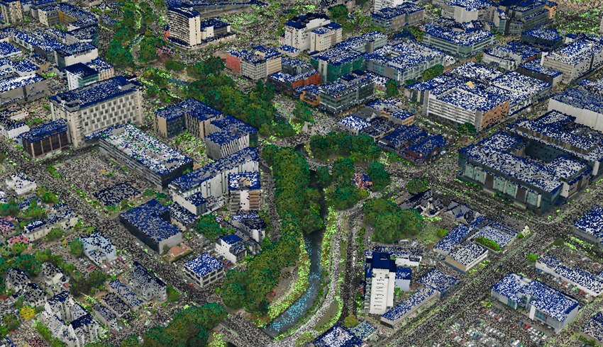
Christchurch City High Density LiDAR Point Cloud data with the Christchurch City 3D Mesh in the 3D viewer
Find out more about elevation data including how elevation data is being used in New Zealand as well as how to use the data by visiting the Elevation Aotearoa Story Map.
Dataset Overview and Download
Pulse density specification is at a minimum of 8 pulses/square metre.
Total number of points: 10,593,179,646
Area: 523 km2
Point Density: 20.25 pts/m2
Prepared DEM and DSM files are available through the LINZ Data Service:
-
Christchurch, Canterbury, New Zealand 2020-2021 Digital Elevation Model (DEM)
-
Christchurch, Canterbury, New Zealand 2020-2021 Digital Surface Model (DSM)
LAS Point Cloud and vendor project reports are available from OpenTopography