Historic Record Register
Historical Records from around the Canterbury Region.
Created by: canterburymaps
Last updated: Tuesday, July 27, 2021
Description
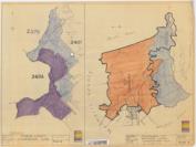
Environment Canterbury has a large collection of historical records from around the region. The records include oblique and aerial photographs, farm plans, river and drainage classification, land survey data and building and structure plans. Each document is marked by a point or area to indicate the location that the record refers toFind out more about this app here
Map Credits
Environment CanterburyAccess and Use Constraints

Map Contents
Basemap:
- {{layersInfo.baseMap.title}}: {{layer.url}}{{$last ? '' : '; '}}
Operational Layers:
- {{layer.title}}: {{layer.url}}
