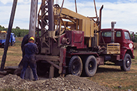
Tools for Well Drillers
Description
A series of spatial data layers to assist Well Drillers in the field around the Canterbury Region as part of the Bore Installers Programme.Map Credits
Environment Canterbury, Land Information New Zealand, GNS Science, Ngai Tahu, Department of Conservation,New Zealand Archaeological AssociationAccess and Use Constraints
This web map contains a collections of layers sourced from multiple organisations.
Environment Canterbury and Land Information New Zealand layers are licensed under a Creative Commons Attribution 3.0 New Zealand License
Layers from all other organisations are strictly copyright.
Map Contents
Basemap:
- {{layersInfo.baseMap.title}}: {{layer.url}}{{$last ? '' : '; '}}
Operational Layers:
- {{layer.title}}: {{layer.url}}
