News
RetroLens.nz
A historic imagery scanning project has been beavering away digitising the Crown aerial imagery archive in the interest of long term preservation, easier access, and better use of this valuable national resource. This current project underway involves digitising more than 600,000 images which date from the 1930s to present day. The project is managed by LINZ, but is a jointly funded project by the following local authorities/ shared services:
- Auckland Council
- Bay of Plenty Regional Council
- Environment Canterbury
- Gisborne Regional Council
- Hawkes Bay Regional Council
- Southland Regional Council
- Tasman District Council
- Waikato LASS
Overall, the total project cost is estimated to be $5 million. Environment Canterbury will spend about $300,000 on digitising the images of Canterbury.
As at June 2016, 150,000 images have been scanned and delivered to the partners. It is estimated, Bay of Plenty and Gisborne to be completed in June 2018, Waikato in December 2018 and the others in 2020. The whole project is expected to be finished by 2021.
The Local Government Geospatial Alliance identified the need of its councils’ customers to access the rich resource of historical images in an open and freely accessible application. It needed to be simple and easy to use. Instead of creating several separate resources to access this resource the following local authorities / LASSes jointly funded a national website called RetroLens:
Canterbury Councils, Hawke’s Bay Regional Council, Waikato Regional Council, Bay of Plenty Regional Council, Tasman Regional Council, Southland Regional Council, Marlborough District Council
This website, retrolens.co.nz , went live today ...
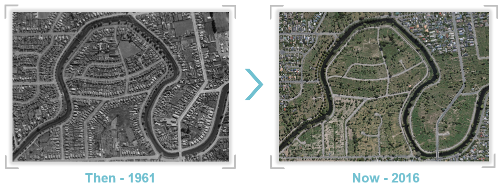
On the website you can search for an address or location and go back in time to see what the land was like from years gone by.
The below picture is from Christchurch in the 1961's.
Discover what the land was like in your area, start discovering now on RetroLens.