News
Rangitata River Flooding in December 2019
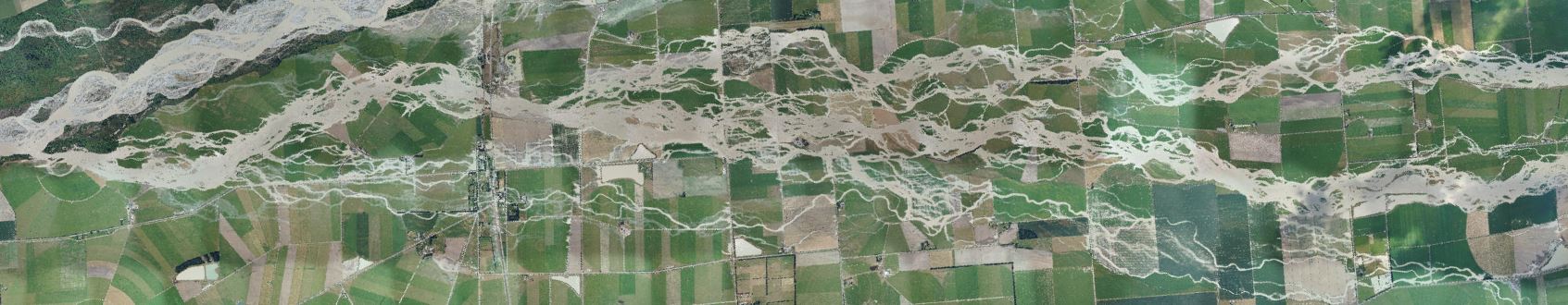
Environment Canterbury's team of scientists and engineers have captured images of the south branch of the Rangitata River during the December 2019 flooding. Several hundred vertical photos were taken on the 9th of December 2019. These were combined together using specialist software and a technique called “mosaicing” to create this single image. It is important to note that due to some technical constraints, the images are not considered to be 100% accurate in regards to location.
For a quick compare between the flood photo and the regular aerial photo please use this map application.
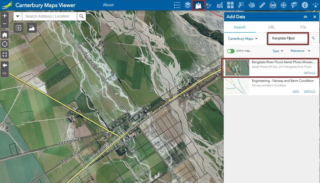
You can also find the imagery using the add data tool in the regular map viewer to use in conjunction with all other layers and tools as per the screen shot below.
For more information on the aerial photos please read this link.