News
Check out our newly digitised historic maps (Black Maps)
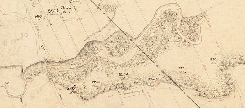
Discover what Canterbury looked like in the 1800s during early European settlement by looking at the Black Maps on Canterbury Maps.
‘Black Maps’ is a short-hand term for some of the earliest survey plans of the Canterbury Land District. They were created in the mid 1800s, although some continued to be annotated well into the twentieth century. These maps give an insight into traditional areas of mahinga kai (sites of significance to Māori for food gathering) such as wetlands, lagoons, and estuaries before they were modified.
Te Rūnanga o Ngāi Tahu have led a project with support from Environment Canterbury, Land Information New Zealand (LINZ), Micrographics and Archives New Zealand to digitise the original paper copies to preserve the information and make them more accessible to the public. The newly digitised maps are available on Canterbury Maps and have just been updated to include new areas in Ashburton, Timaru and Mackenzie.
Check the maps out in the 19th Century Black Maps Map Viewer or use them as Basemaps in the Map Viewer.
Find out more about Black Maps and the mapping project by reading the Historic South Island Survey Maps Story Map
Original Black Maps
The original paper copies of the black maps have been transformed into spatial data. They are scanned and then georeferenced to make them digitally available. These digital maps have then been combined into a single layer and made publicly available on Canterbury Maps.
Add the Black Map - Originals layer to the Map Viewer or add the layer to your GIS application by connecting to our services.
Digitised Black Map
The information on the original paper copies of the black maps have been digitally traced to create a series of spatial datasets representing the historical location of natural and cultural features including rivers, lakes, wetlands, coastlines, vegetation, Māori place names and cultural sites. These datasets are easier to read and understand compared to the Black Maps - Originals Layer.
Add the Black Maps - Digitised layer to the Map Viewer or add the data to your GIS application by connecting to our services.
