Highly Productive Land - NZLRI LUC Classes 1 - 3
Highly Productive Land - NZLRI LUC Classes 1 - 3
Created by: canterburymaps
Last updated: Friday, April 19, 2024
Description
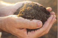
This map is to show the highly productive land baseline as per the Proposed NPS (released August 2019) on the use of land use capability (LUC) classes 1-3 as a starting point for defining the resource. See document below
https://www.mpi.govt.nz/dmsdocument/36621-valuing-highly-productive-land-a-summary
LUC classes are a component of the NZLRI dataset; metadata is below.
Sourced from Manaaki Whenua Landcare Research @ http://www.landcareresearch.co.nz/databases/nzlri.asp This layer includes: (1) Inventory of physical factors controlling land use - Rock (grouped by type on basis of common physical characteristics relevant to soil conversation and land use planning), Soil (from Landcare Research soil surveys), Slope (recorded as seven different classes A-G, eg G being all land >35o, Erosion (14 erosion types with serverity assessement scale 0-5), Vegetation (subdivision of five main groups - croplands, grasslands, forest, scrub, miscellaneous); (2) Land Use Capability (LUC) assessment by map unit - Class (I-VIII ie 'most versatile and productive' to 'most limitations to use'), Subclass (dominant limitation recorded ie e-'erodibility', c-'climate', w-'wetness', s-'soil limitatiojn within rooting zone'), Unit (number indicates LUC and denotes management/conservation requirements) (3) Fundamental Data Layers (FDL) containing key NZ soil attributes; (4) Pastoral & forestry production parameters, administration and natural boundaries.
Map Credits
Access and Use Constraints
Map Contents
- {{layersInfo.baseMap.title}}: {{layer.url}}{{$last ? '' : '; '}}
- {{layer.title}}: {{layer.url}}