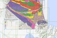
Canterbury Historic Plans Register
The Canterbury Historic Plans Register is an interactive application built to share our history.
Created by: canterburymaps
Last updated: Thursday, March 16, 2017
Description
Environment Canterbury holds land use, subdivision surveys, drainage, flooding and farm plan records dating back as far as the 1820’s. The plans have come from predecessor agencies including Canterbury region’s United Councils and Catchment Boards, Pest Boards and Harbour Boards.For additional help click here...
Map Credits
Environment CanterburyAccess and Use Constraints

Map Contents
Basemap:
- {{layersInfo.baseMap.title}}: {{layer.url}}{{$last ? '' : '; '}}
Operational Layers:
- {{layer.title}}: {{layer.url}}
