Sub Regional Plan Areas
Map viewer containing areas that relate to specific sub - regional plans.
Created by: canterburymaps
Last updated: Wednesday, July 14, 2021
Description
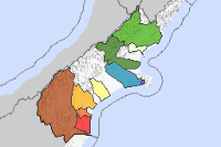
This map viewer allows the user to identify areas that relate to different sub regional plans and look up the associated rules.Clicking on a map area creates a pop up which contains a reference link to the specific sub regional plan information:

Map Credits
Environment CanterburyAccess and Use Constraints

This work is licensed under a Creative Commons Attribution 3.0 New Zealand License
Map Contents
Basemap:
- {{layersInfo.baseMap.title}}: {{layer.url}}{{$last ? '' : '; '}}
Operational Layers:
- {{layer.title}}: {{layer.url}}