Cultural/Heritage Places of Canterbury
Locations and details about significant cultural and/or heritage places in Canterbury sourced from the Canterbury Maps partners, Heritage New Zealand Pouhere Taonga and QEII National Trust.
Created by: canterburymaps
Last updated: Friday, April 19, 2024
Description
Locations and details about significant cultural and/or heritage places in Canterbury sourced from the Canterbury Maps partners, Heritage New Zealand Pouhere Taonga (‘Heritage New Zealand’) and QEII National Trust.The New Zealand Heritage List/RÄrangi KÅrero information included here is supplied with permission from Heritage New Zealand and is correct as at the date shown in each features date supplied field.
Please contact Heritage New Zealand (www.heritage.org.nz) for the latest New Zealand Heritage List information.
List entry coordinates should be read in conjunction with the other location
information in the New Zealand Heritage List.
Queen Elizabeth II (QEII) National Trust helps private landowners in New Zealand protect special natural and cultural features on their land with open space covenants. QEII National Trust Open Space Covenant information is shown here under permission from the QEII National Trust, for further information please visit http://www.openspace.org.nz/Site/Home/default.aspx
Map Credits
Heritage New Zealand Pouhere Taonga, Canterbury Maps Partners, QEII National Trust.Access and Use Constraints
New Zealand Heritage List/RÄrangi KÅrero - Copyright Heritage New Zealand Pouhere TaongaCultural/Heritage Sites sourced from the Canterbury Maps partners -  Creative Commons Attribution 3.0 New Zealand License
Creative Commons Attribution 3.0 New Zealand LicenseQEII National Trust Open Space Covenant information is shown here under permission from the QEII National Trust, for further information please visit http://www.openspace.org.nz/Site/Home/default.aspx
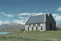
Thumbnail:
Church of the Good Shepherd, Lake Tekapo. Wells, Robert E, 1905-2006 :
Photographic negatives, prints and transparencies of the Mokau and other rural North Island districts, and scenic views of New Zealand.
Ref: Photobank-85-47126. Alexander Turnbull Library, Wellington, New Zealand.
Map Contents
Basemap:
- {{layersInfo.baseMap.title}}: {{layer.url}}{{$last ? '' : '; '}}
Operational Layers:
- {{layer.title}}: {{layer.url}}